Hammertime: THOR’s Cores
/Linda Welzenbach and Becky Minzoni
“Where’s the mud people?” asks Marine Technician Joee Patterson from the doorway of the E-lab the morning of 6 March. If all goes to plan, THOR’s Hammer would deliver 8 cores of mud from the deep sea in front of Thwaites over the next 24 hours. As with most science conducted aboard a research ice breaker in Antarctica, there will be successes, there will be set-backs, and there will be adjustments. By the end of the day, however, the THOR team will get their mud.

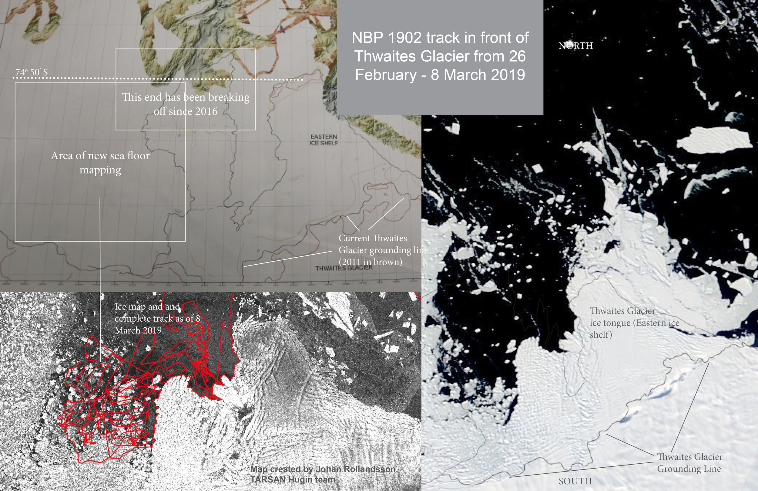
Composite map showing more than a decades-worth of combined seafloor bathymetry used to help identify core sites.
The THOR team will tell the story of Thwaites Glacier from what they find on the sea floor. Until now the focus has been on multibeam mapping of the underwater topography, and the details of Thwaites’ story will be fleshed out through detailed study of the muddy sediments that rest on the seabed. Mud is defined in Webster’s dictionary as a “slimy, sticky mixture of solid material with a liquid (e.g. water).” The mud that THOR seeks is slimy and sticky and at times even soupy, with consistency ranging from Nutella to chunky peanut butter, and other not so complimentary comparisons that are an endless source of amusement for the scientists.
For THOR, the sometimes pungent, green, brown to gray colored mud holds the key to their questions of how Thwaites Glacier behaved recently and back to the distant past. Sea floor mud contains bits and pieces of old Antarctic continent that has been ground into sand, silt and clay by glaciers scraping the land. The ice carries its sediment cargo off the continent and into the sea. The seafloor mud hosts life at its surface, and remains of dead organisms as evidence of past ocean conditions. The sediment similarly traps water as it is deposited on the ocean floor, and records environmental regimes that operated below and in front of the glacier from thousands of years ago to the present day. These are the key clues that will help us tell Thwaites story.
Joey Patterson tests the strength of the sea ice prior to deploying the Kasten corer.
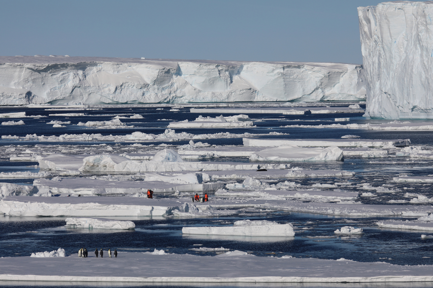
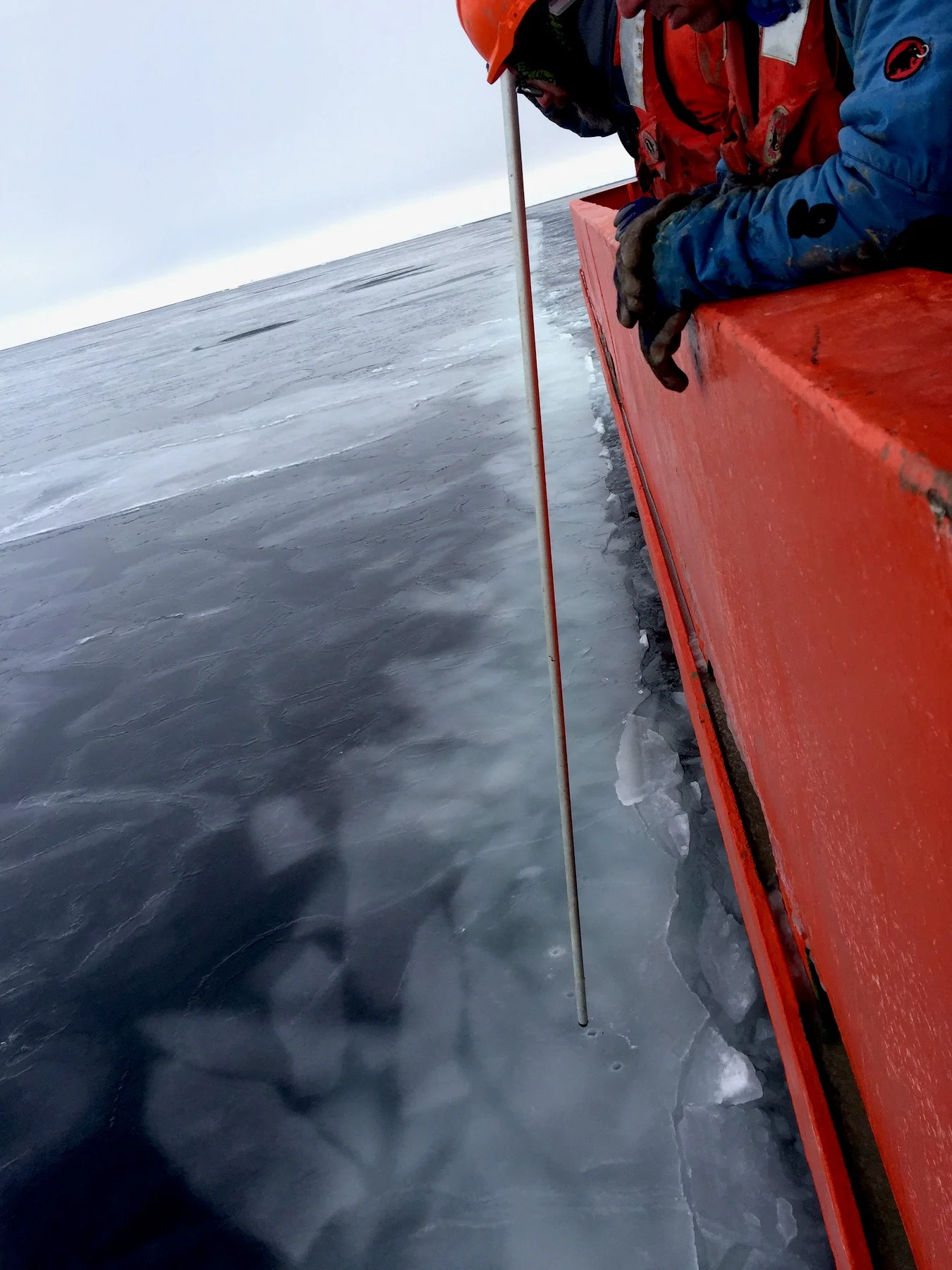
The depth of the sea floor, even as we sail close to the ice shelf, is astounding. At Thwaites, depths range from less than 100 meters (300 feet) to over 1200 meters (3600 feet). To access the sea floor in Antarctica you need a ship that can remain “on station” without an anchor, that can battle ice, and that must be reinforced with steel framing and a winch system to deploy coring devices to great depths, where the gear becomes increasingly heavy. The captain and crew work diligently to monitor and avoid ice bergs and sea ice during coring operations.

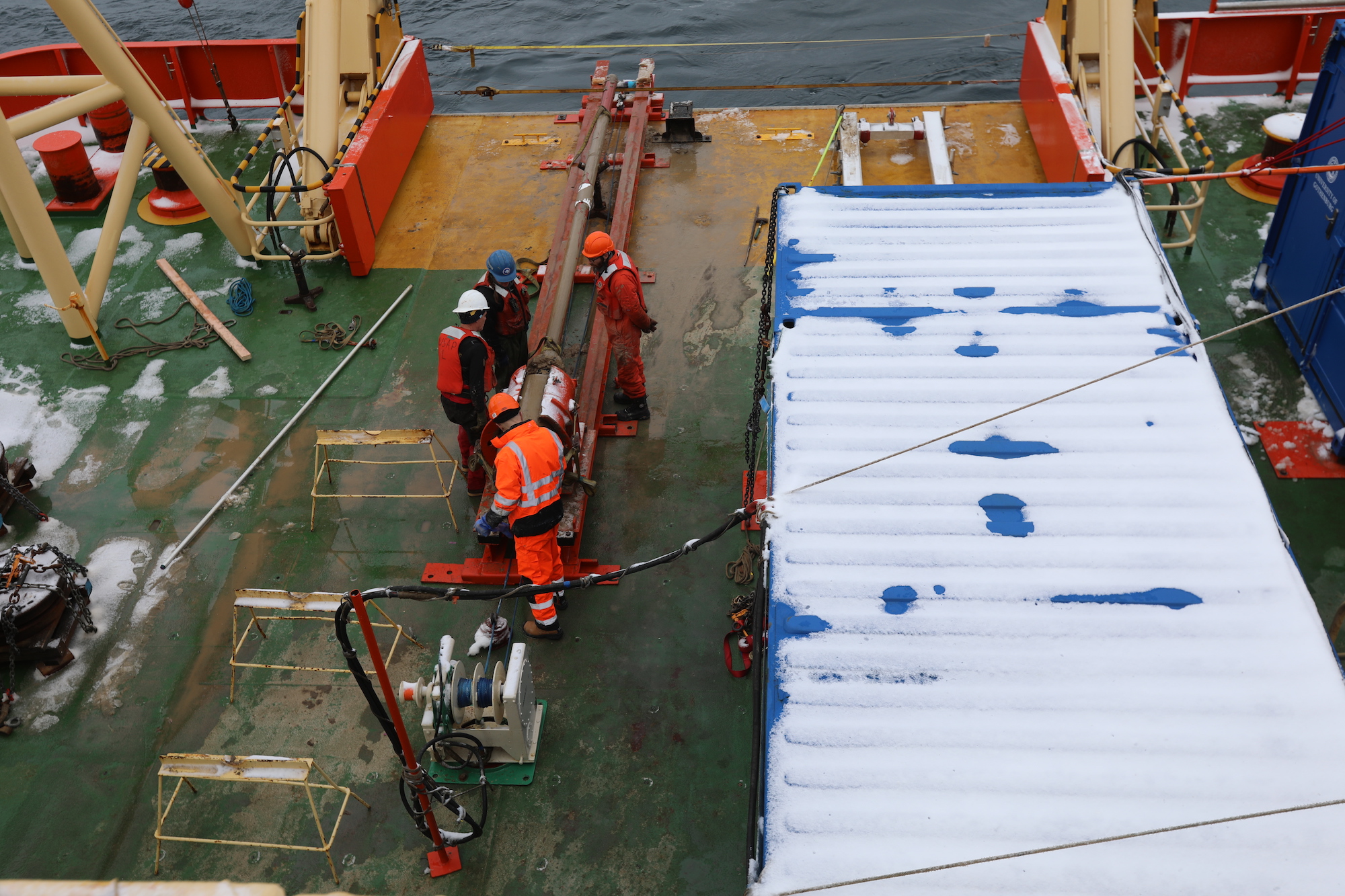
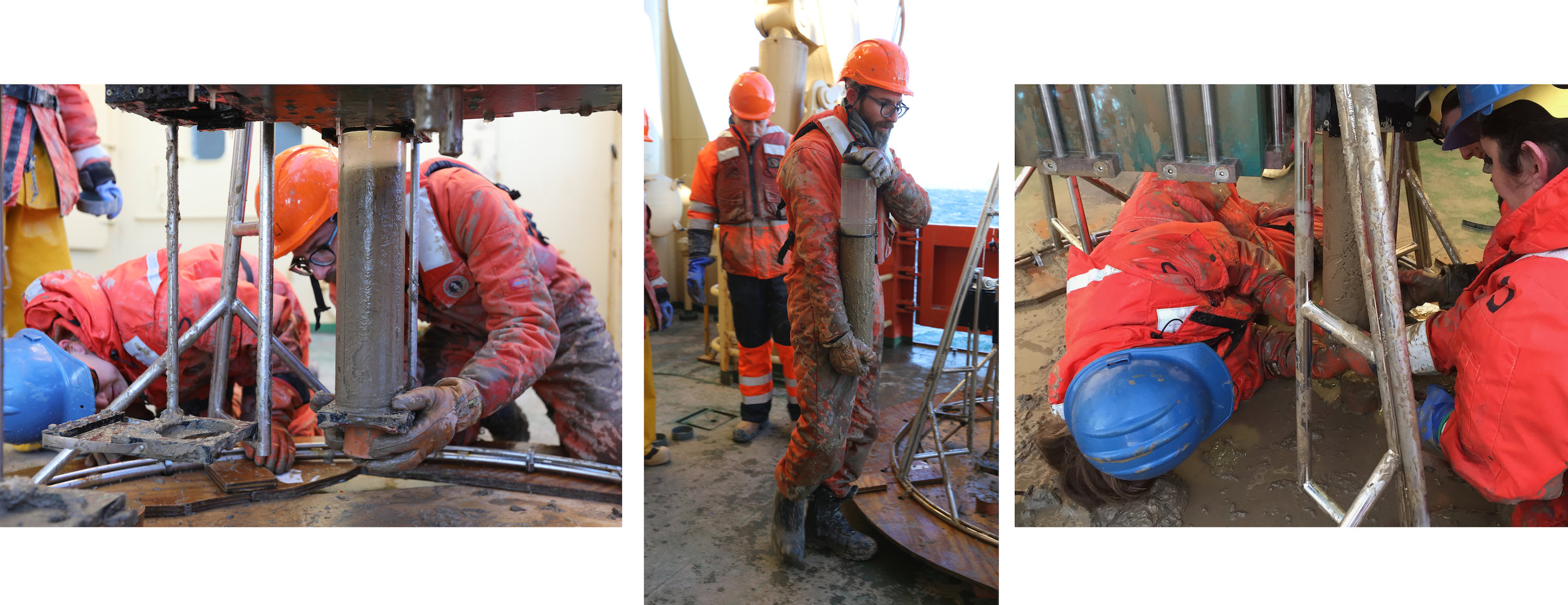
Night coring! Snow and wind batter the THOR team as a Kasten corer is brought back on deck. The wire holds the top of the corer at an angle to allow the THOR team to put spacers into the top of the core. Just below where the wire is connected to the top of corer are the weights that help force the barrel down into the sea floor.
The coring device consists of a large weight on top of a metal barrel that is suspended from a wire and lowered through the ocean to the sea bottom. The barrel penetrates the sea floor mud like a straw, collecting up to maximum of 6 meters of sediment. Imagine trying to drop a skinny straw suspended from a thread through a glass of swirling milk with chocolate syrup on the bottom, and keeping it straight. In depths of a thousand or so meters, dropping the straw onto the ocean floor can take more 30 minutes, and it takes much longer to properly assemble and deploy the core device into the water. All the while the ship has to remain stationary, especially in heavy or icy seas, for the final drop so that the corer doesn’t end up leaning to its side or falling over. Most of the time, the corer successfully collects sediment. That is, if the geophysicists and geologists make a good estimation of mud type and thickness prior to coring!
How do we decide where to collect sea floor mud? Despite the astounding depths of the coring operations, site selection is not blind. Selection involves information gathered by the ships’ multibeam mapping and sound imaging of the mud and bedrock just beneath sea floor. Doing it well requires experience and interdisciplinary collaboration. THOR team on NBP1902 includes three geophysicists who specialize in geomorphology (Rob Larter, Ali Graham, and Kelly Hogan) and a geologist who specializes in sedimentology and paleontology (Becky Totten Minzoni). Each project investigator brings their experience and expert knowledge to the table to target the best places that can create a complete picture of an area. They also have to consider the tools they will use to gather the best samples, within the constraints of time and manpower.

(Left to right) Rob Larter, Ali Graham and Becky Minzoni compare the Knudsen sub-profile images with new bathymetry gathered after arriving at Thwaites glacier.
At each shift change the team meets to pore over both the recently collected multibeam bathymetric data and the Knudsen sub-profile imagery as it is captured in real time. For this cruise, the areas selected will tell a discrete story for the now ice-free ocean in front Thwaites, yet also provide a framework for planning the activities during the THOR cruise next season. When selecting a site, the main characteristics the geoscientists look for are sedimentary layers (reflections in the sub-bottom profiler) from target depths that typically preserve shells, which are used to date the advance and retreat history of the ice sheet and ice shelf.

The Palmer is amazingly agile for all its ice-busting power. It has thrusters on all sides that allow it to remain “on station” for a particular site so that it can deploy science assets from the starboard and aft sides of the main deck. This is particularly useful for coring, as different cores types can be deployed efficiently at the same site.
The team plans to gather eight cores. A suite of cores from three different sites will be taken along a transect from a deep basin to a high point near the modern ice shelf. All of these cores will tell the geoscientists about the recent retreat of the Thwaites ice shelf over the last century.

Outlined on the board is a cross-section that represents a transect from the deep basin to the high point in front of Thwaites requires a variety of coring types, including the Kasten core, the Megacore, and the jumbo gravity core.
They pick the the Kasten corer to use first. The Kasten is the primary go-to system employed to explore the sea floor because it can sample a variety of sediment types. The Kasten core results are then used to decide the next core type to use. The Kasten has a square barrel that is screwed together with plates to capture up to 3 m of sediment. Attaching weights around the square barrel up to 15 tons, the corer is sent to the seafloor by its wire tether at a particular rate (ranging from 10 to 30 meters per second). The weights and the speed of impact are optimized for extraction of different seafloor sediment densities and strengths. THOR team watches a monitor that displays the tether wire tension, both before and after the corer impacts the sea floor. An increase in the wire tension after it is pulled from the seabed is a first indication that tells the team how well the corer performed and how much material they may have collected.

Pictured Left to Right: James Kirkham; Marine Technician Jack Greenberg and the THOR team; Kelly Hogan and James Kirkham and the THOR team.
After a long wait for one of the Kasten cores to resurface, the marine technicians Joee Patterson and Jack Greenberg settle the bottom end of the core into a heavy duty metal “basket” mounted on the deck, allowing it to pivot gently, while draining some of the seawater from the top. Once the overhead winch is secure, the THOR team springs into action. The first thing is to preserve the integrity of the softer sediments in the top of the core with a perfectly cut foam block they have prepared. Once the core is separated from its top weights, everyone helps to heave the hundred plus pound full core barrel onto a cart, which is carefully rolled across the deck to the Baltic room where it will be carried into the lab for a long night of processing, sampling, and describing.

The THOR team (pictured left to right: Rob Larter, Ali Graham, Victoria Fitzgerald, Kelly Hogan, Rachel Clarke, Tasha Snow, Becky Minzoni) place the core barrel on the table.
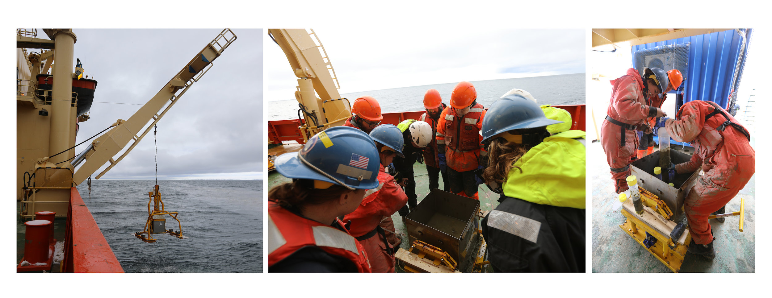
Muddy floatcoats, hard hats and unwieldy steel toed boots forgotten, we all hasten to unveil the sticky treasure within the barrel that holds other worlds from the deep ocean beneath our feet. Once we remove the lids of the Kasten core barrel, it becomes apparent that the very top of the seafloor was washed out, a not uncommon result of Kasten coring, especially when the seafloor muds are soupy and soft. Immediately following this assessment, Becky Minzoni and Ali Graham quickly decide that the soupy sea floor surface absolutely must be captured from this site. That’s where the Megacorer comes in.

Unlike the single-strike gravity driven corers, the Megacorer is a set of 12 short precision hole punches. The tubes are mounted to a metal frame, that can be deployed with a wooden foot that can act as a “snow shoe” to keep it from pushing too far down through the soft, soupy sediment. When the tethered frame hits the bottom, a piston pushes the 12 tubes into the sea floor. A guillotine-like door closes off the bottom of the tubes and a lid seals the top of each tube. If the conditions are optimal, all 12 core tubes will be filled with 50 cm of perfectly preserved upper sea floor mud and sea water, and may also include the occasional squiggly Antarctic creature.


Yet, more often than not, some number tubes will be empty. Rocks, thick sticky mud, or tilt of the frame may impact the function of the trigger systems. The redundancy of 12 tubes provides more than enough material, and will capture at least some sediment even in less than optimal conditions.
Despite nearly 50 years of collecting and refining the coring process, the one constant is mud. Everywhere. Especially for the samples from the Megacorer which need to be handled with utmost care in order to preserve the seawater/seafloor mud and the interface between them. It takes teamwork and good timing to extract the core tubes from the framework. Pictured Left to Right: Becky Minzoni, Ali Graham; Rob Larter and Ali Graham; Becky Minzoni, Victoria Fitzgerald.
An alternative to Megacores is the mighty box core. The box corer uses a frame similar to the Megacorer, but instead of 12 individual tubes, it forcefully inserts a metal box into the seafloor and then triggers a scoop that slides underneath to seal and hold the bottom.
The box core preserves the upper seafloor like the Megacore, but the box core does so as a larger and sturdier unit that provides more material in context. The box core is usually used for biological studies, and the sampling methods are flexible, allowing a variety of archiving tubes to be extracted from the sediment section. While the box corer was not used in the Thwaites coring transect, it was tested in an area of the eastern Amundsen Sea and will be employed in the 2020 THOR cruise.
Marine technicians and observers on the main deck look at the contents of the box corer. Beck Minzoni, Rob Larter and Ali Graham pull out one of the core samples taken from the box core.
Last but not least is the Jumbo gravity corer. The Jumbo is a metal barrel lined with PVC pipe, and has a heavy weight on its top that can capture up to 6 meters of sediment on this cruise. The PVC liner is extruded from the barrel and archived immediately following extraction. Extrusion happens on the deck right after it is secured at the surface. The core liner is pushed from the coring tube, cut into measured lengths, briefly described, capped and immediately refrigerated. It will later split into halves, with one half held as an archive and the other for sampling. These archives will be useful for years to come.
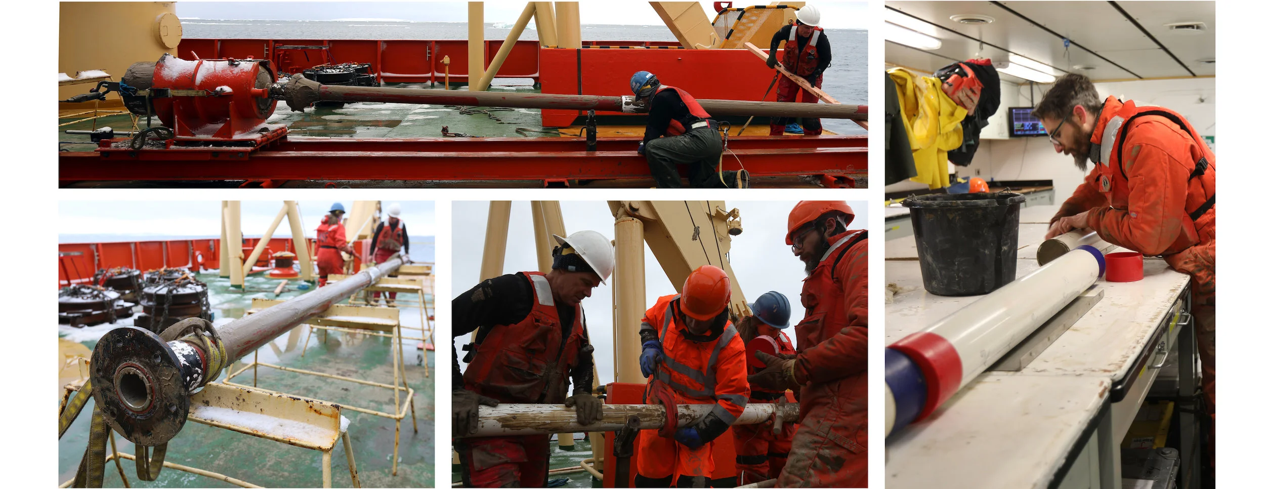
The core barrel is attached to a top weight, similar to the Kasten corer. Once removed from the weight the barrel liner holding the core can be pushed out and cut into sections. Pictured left to right: MT Jack Greenberg, Rob Larter, Becky Minzoni, Ali Graham; Ali Graham cleans and caps off the JPC core sections.
Within 36 hours, THOR deployed all but the box corer to collect 6 cores out of 8 attempts, but with end result achieving a full sample of the targeted transect, including both sea floor surfaces and long sediment records. As of the 12th of March, the THOR team completed 28 coring events resulting in 26 cores. Each one will provide samples to all the science team members and provide the foundation for a more extended coring strategy for next year’s cruise.